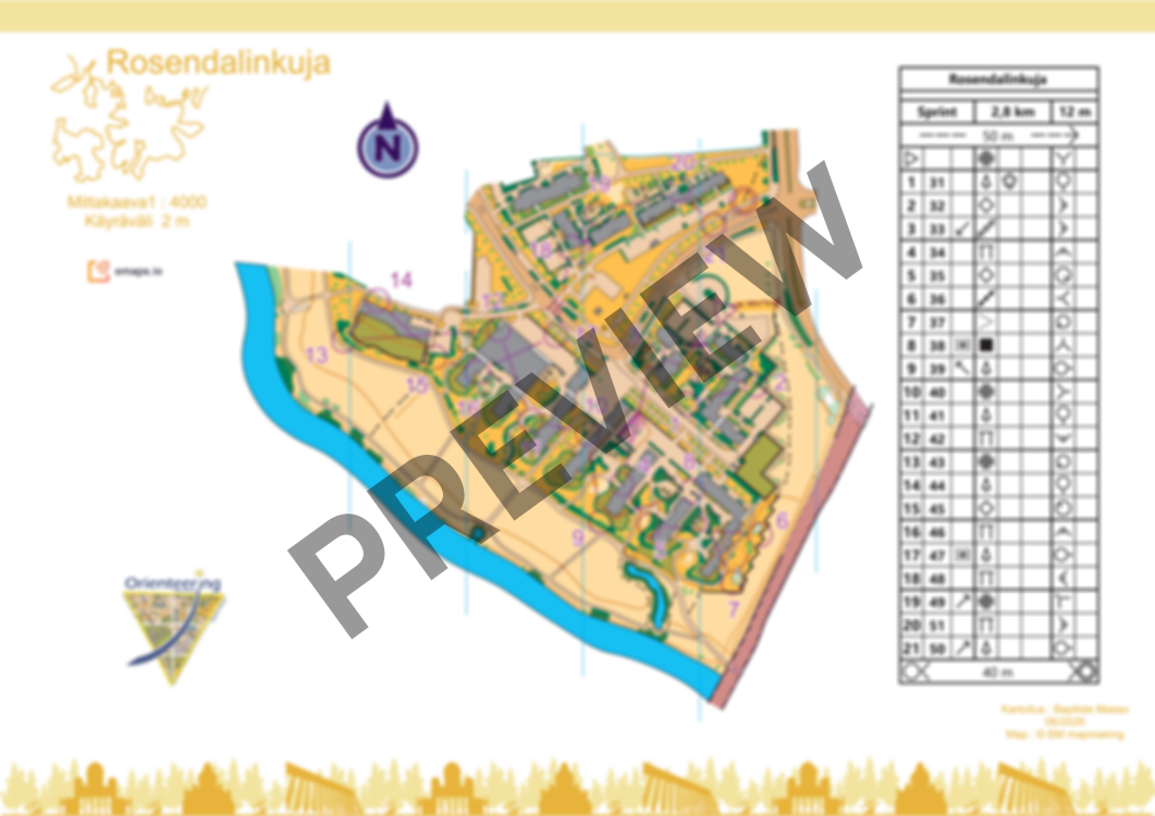
Rosendalinkuja
 Map by Baptiste Masso
Rosendalinkuja
New map of Rosendalinkuja (Tammisto). Mainly open parks, residential areas with gardens. Fast grassy terrain with almost none elevation changes. Some private areas. Light traffic.
Please respect private areas, forbidden areas, and the nature (bird nests and flowers). Avoid spike shoes.
The course is 2,8km. There is no flags on the terrain.
Map has been made in June 2026. You can also order the map without courses.
Log in to comment