Vallilanlaakso_Course A
 Map by Baptiste Masso
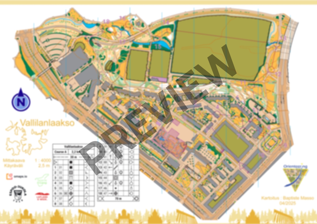
Vallilanlaakso_Course A
New fresh map of Vallilanlaakso, allowing you to connect Alppila to Kumpula.
Alternating between detailed park areas and residential zones. Some private areas.
Please respect private areas, forbidden zones, dangerous areas (such as impassable cliffs), and nature (bird nests and flowers). Avoid wearing spike shoes. Be careful with the tram line – it can be crossed, but do not run along it.
The course is 2.2 km long. There are no flags in the terrain.
The map was made in April 2025. You can also order the map without courses.
Log in to comment