Uunisaari & Liuskasaari 2025
 Map by Baptiste Masso
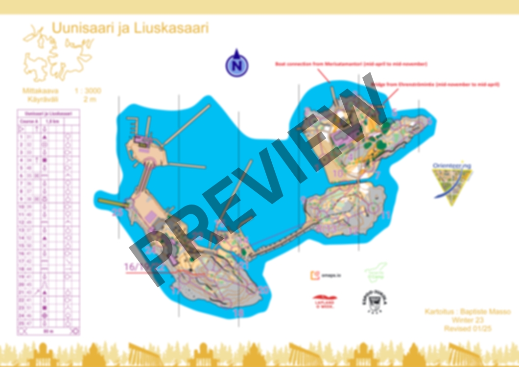
Course A
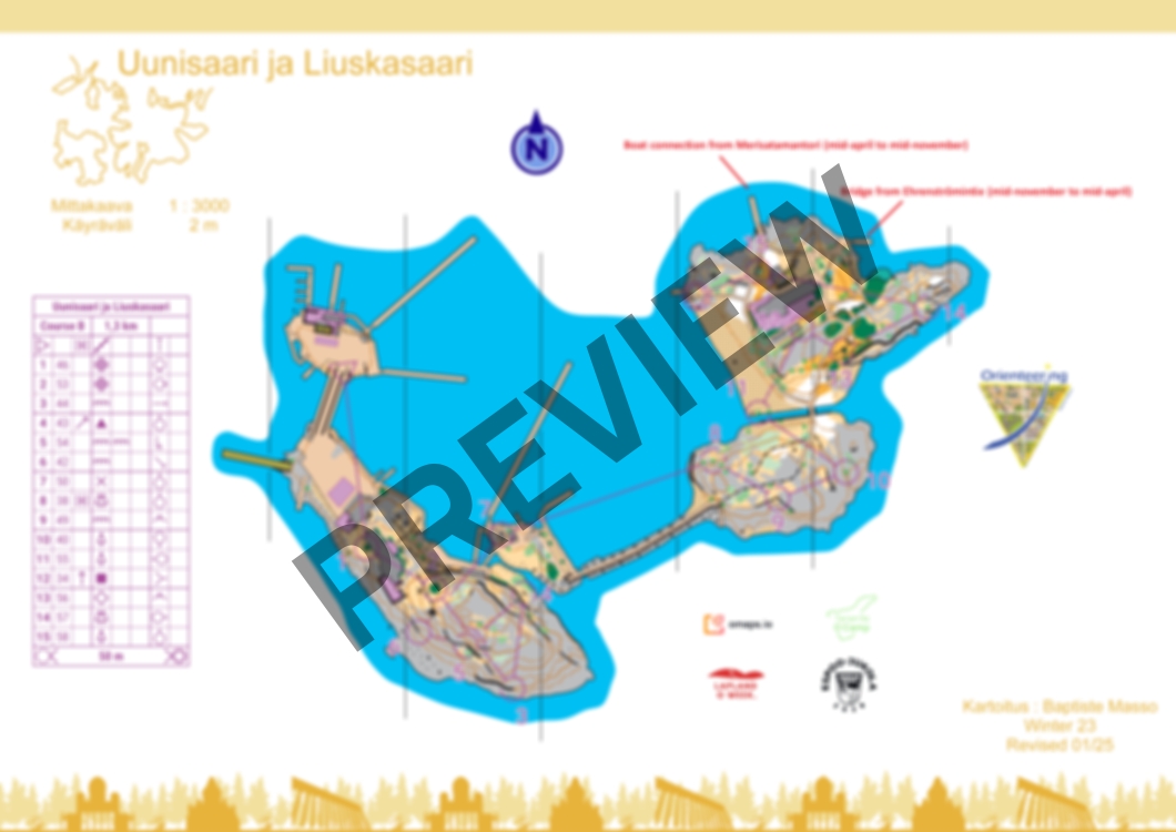
Course B
Uunisaari & Liuskasaari 2025
Alternation of open grassy terrain and bare rock. Many paths with a few buildings.
Please respect private areas, forbidden areas, dangerous areas (impassable cliffs) and the nature (bird nests and flowers). Avoid spike shoes.
2 courses (1,8km + 1,3km) for a total of 3,1km. There is no flags on the terrain.
Map has been made during winter 2023 and revised in January 2025.
The island can be reached from the mainland via a pedestrian pontoon bridge from mid-November to mid-April.
There is a boat connection to the island from Merisatamantori from mid-April to mid-November.
Map Rights belong to Rasti-Jyry.
Log in to comment