Suomenlinna – Susisaari 2
 Map by Baptiste Masso

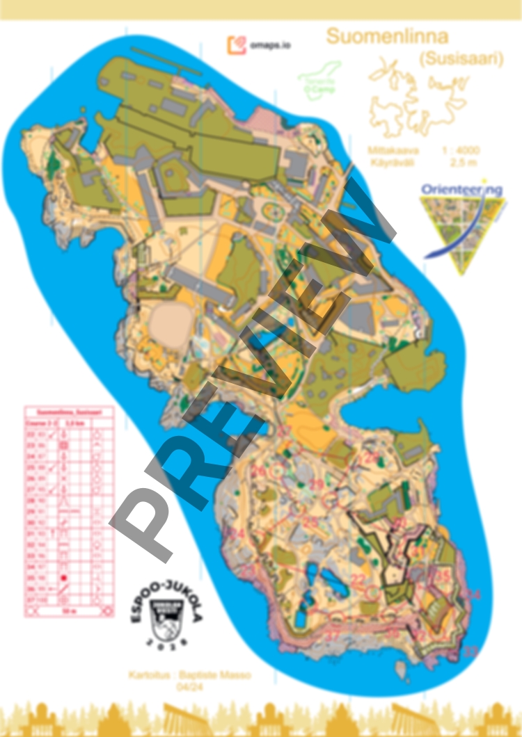
Susisaari is the most varied island of Suomenlinna.
The bare rock areas have been mapped in a simplified way. These bare rock areas are extremely dangerous when wet during rain (with a difference of 10 meters from sea level). There are also many bird nests, and it is one of the only places for them to nest.
Some controls are in the tunnels (TIP: BRING A SMALL HEADLAMP).
Some places are marked with the symbol 709 (out of bounds area, no marked boundary). These places are very steep bare rocks or hills where the vegetation and landscape are protected.
The fences on either side of the stairs are not marked to allow for a better map reading.
As some multi-level areas are quite small, the elements of the upper part have been cut off to allow a clear view of the tunnels.
Not all tunnels are mapped; only the most interesting and less dangerous ones have been represented. Some of these unmapped tunnels are blocked by barriers due to falling rocks inside. Do not go there under any circumstances.
Due to the large number of purple areas (forbidden) and to maintain good map readability, the courses have been drawn using red color.
Please respect private areas, forbidden areas, dangerous areas (impassable cliffs) and the nature (bird nests and flowers). Avoid spike shoes.
The course is 3,0 km in total with a flip map over. There is no flags on the terrain.
Map has been made in April 2024. You can also order the map without courses.
Enjoy !